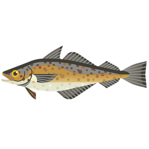
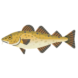
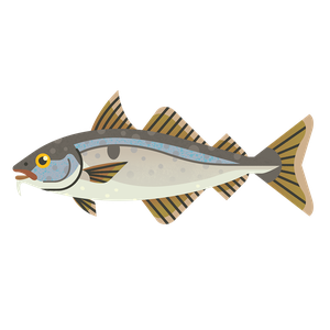
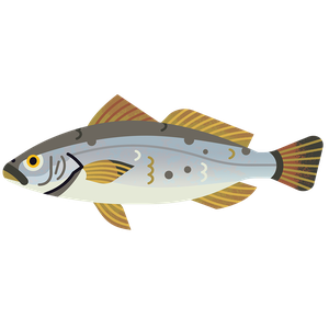
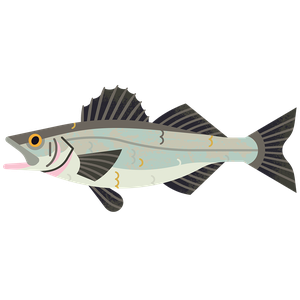
Whiting
Merlangius merlangus
What to check for
Location
Location
Location refers to two things:
- Where the fish population or stock lives, e.g., North Sea, or South Pacific.
- Who is managing the fishery. If it says “All areas”, this means that our scoring for management covers the same area as the fish stock.
Irish Sea: All areas
Technical location
Technical location
A global system is used to split the ocean into different zones, areas, and subdivisions. Each zone is indicated by a number and/or letter. By law, this must be shown on all unprocessed seafood sold in the EU and UK, alongside the fishing method used to catch it. Look for these details on the packet to match your seafood to our ratings.
7a: Irish Sea
Caught by
Caught by
Bottom trawl (otter)
Otter trawling involves towing a net over the seabed. The net is held open by two panels, known as otter boards. Fish are herded between the boards and into the net, which is then hauled onto the boat.
Bottom trawl (otter)
Rating summary
Irish Sea whiting is below safe biological levels and there are no measures or plans in place to help it recover. Therefore, it receives a critical fail for stock status and is a default red rating.
Rating last updated August 2024.
How we worked out this Rating
Stock status
The size and health of a fish population, or 'stock', that is being targeted by fishermen is a crucial indicator of whether a fishery is sustainable. If the stock is too small to withstand fishing, it is at risk of crashing. We look at how big the stock is, and how much pressure there is from fishing, to assess this. The target level that many fisheries aim for is 'Maximum Sustainable Yield' - the most fish that can be caught year after year whilst keeping the population at a healthy size.
Whiting in the Irish Sea is below safe biological levels and there are no measures or plans in place to help it recover. Therefore, it receives a critical fail for stock status and is a default red rating.
This stock assessment is carried out biennially by the International Council for the Exploration of the Sea (ICES). The most recent assessment was published in 2023 using data up to 2023. The next assessment is expected in 2025.
The stock assessment defines reference points for fishing pressure (F) and biomass (B). For fishing pressure, there is a target to keep F at or below Maximum Sustainable Yield (MSY). For biomass, there is no target. However, there is a trigger point (MSY BTrigger). Below this level, F should be reduced to allow the stock to increase. Because BMSY is not defined, the Good Fish Guide applies its own definition of 1.4 x MSY BTrigger.
The Irish Sea whiting stock has been declining since the early 1980s, when the spawning stock biomass (SSB) was over 20,000 tonnes. It reached an all-time low of 530 tonnes in the mid-2000s, and has been at dangerously low levels since. In 2023 it is 1,517 tonnes - far below the level at which reproduction is impaired (Blim, 10,000t). The target biomass (MSY BTrigger) is 16,300t, putting current stock size at just 9% of sustainable levels. The stock is therefore in a very overfished state, outside safe biological limits, and suffering reduced reproductive capacity.
Since 1980, fishing mortality (F) has been above levels associated with Maximum Sustainable Yield (FMSY, 0.22) and upper limits (Flim 0.37). In 2022 it was 0.50. Irish Sea whiting is therefore subject to overfishing.
ICES advises that when the MSY approach is applied, there should be zero catches in each of the years 2024 and 2025. This is because there is no scenario in which the stock can return to above Blim over the next two years. Zero catch has been advised since 2001. Over that time catches have not significantly reduced. A zero catch in 2024-2025 would allow the stock to increase by 93%, but maintaining the fishing pressure at recent levels is projected to cause it to decline by 8.5%.
Management
Good management is vital to be sure that fishing doesn't cause fish populations to decline. We look at whether regulations follow the best available scientific advice, how well compliance is monitored and enforced, and whether this is effective in maintaining healthy fish stocks.
There are few appropriate management measures in place for whiting in the Irish Sea. The stock is far below safe biological levels, and there is no appropriate recovery plan in place.
There is no management plan for Irish Sea whiting. This stock is assessed by various countries. The stock is covered by the EU Multi Annual Plan (MAP) for Western Waters, however there is no joint management plan between the EU and UK. Most catches are by the UK, followed by Ireland. Whiting in this area are mainly a bycatch species. Around 95% of catches are by trawlers fishing for Nephrops, most of which are then discarded at sea.
Catch limits (Total Allowable Catches, TACs) are in place for all fleets fishing for Irish Sea whiting. ICES has advised that there should be zero catch of this stock since 2001. However, catches have continued. TACs were reduced from over 1000 tonnes in 2002 to 80 tonnes from 2012-2018, but they only applied to landings, and didn't account for discarding of unwanted whiting at sea (i.e. from the Nephrops fishery). From 2019-2023 catch limits were increased to 720 tonnes or more to account for discarding, and catches still exceeded this increased limit in 2022. Catches have therefore been allowed despite the scientific advice, and the TACs are not controlling catches. Therefore, management is not based on the best available science and is not allowing recovery of this highly depleted stock.
ICES has advised that removing the TAC could lead to the stock being unsustainably exploited but also notes that the TAC is not currently controlling exploitation.
A zero catch in 2024-2025 is projected to allow the stock to increase by 93%, but maintaining the fishing pressure at recent levels is projected to cause it to decline by 8.5%. Assuming that the Nephrops fishery maintains recent catch levels, it is expected that whiting bycatch will be 1126t, this is expected to allow for a 1% increase in biomass.
The majority of whiting caught are discards in the Nephrops fishery and are below the minimum conservation reference size (MCRS) of 27cm. Whiting now mature well below this MCRS. The introduction of further highly selective gears to reduce finfish catch and discards in the Nephrops fishery, appears to have reduced whiting catches in the last three years. Discards remain high relative to the landings; on average, 93% of the catch was been discarded from 2018-2022.
Management measures to protect cod, e.g. seasonal closures are unlikely to have affected whiting catches. Nephrops vessels can obtain a derogation to fish in certain sections of the closed areas, providing they fit separator panels to their nets to allow escape of cod and other fish. The Nephrops fleet in the Irish Sea are obliged to use one of four types of cod selective measures, namely a 'Swedish' grid; the inclined separator panel, SELTRA trawl or 300 square mesh panel.
The EU and UK both have fishery management measures, which can include catch limits, population targets, and gear restrictions. However, compliance in the EU and UK has been inconsistent, with ongoing challenges in implementing some regulations. The goal of reaching Maximum Sustainable Yield (MSY) by 2020 was missed, with less than half of UK TACs in 2024 following ICES advice. In 2024, the EU and UK reaffirmed their commitment to sustainable fisheries by aligning management with scientific advice to gradually approach MSY. However, no new target date has been set for achieving MSY across all fisheries. The Landing Obligation (LO), an EU law retained by the UK post-Brexit, requires all quota fish to be landed, even if unwanted (over-quota or below minimum size). It aims to encourage more selective fishing methods, reduce bycatch, and improve catch reporting. However, compliance is poor, and accurate discard levels are hard to quantify with current monitoring programmes. The UK is in the process of replacing the LO with country-specific Catching Policies.
The Marine Conservation Society views Remote Electronic Monitoring (REM) with cameras is one of the most cost-effective tools for providing reliable fisheries data and aiding informed management decisions. Fully monitored fisheries enhance collaboration, data accuracy, stock recovery, and reduce impacts on marine wildlife and habitats. However, the full potential of REM may only be achieved when it tracks fishing location and documents catch and bycatch, particularly where vulnerable species and habitats are at risk. As of January 2024, the EU is introducing a Remote Electronic Monitoring (REM) mandate for EU vessels, including CCTV cameras on vessels 18m or more that pose a potential risk of non-compliance, within the next 4 years. Across the UK, different approaches to REM are being taken and legislation is expected to be in place across all 4 countries within the next few years.
The Fisheries Act (2020) requires the development of Fisheries Management Plans (FMPs) (replacing EU Multi-Annual Plans) in the UK. 43 FMPs have been proposed and are at various stages of development and implementation, these should all be published by the end of 2028. FMPs have the potential to be very important tools for managing UK fisheries, although data limitations may delay them for some stocks. It is also essential the UK governments define and adopt a standardised approach or model across the four nations to a universally defined FMP design, to ensure the consistence, quality and coherence of all the proposal FMPs.
The Marine Conservation Society is keen to see publicly available Fishery Management Plans for all commercially exploited stocks, especially where stocks are depleted, that include:
- An overview of the fishery including current stock status, spatial coverage, current fishing methods and impacts
- Targets for fishing pressure and biomass, and additional management when those targets are not being met, based on the best scientific evidence
- Timeframes for stock recovery
- Improved data collection, transparency, and accountability, supported by technologies such as Remote Electronic Monitoring (REM)
- Consideration of wider environmental impacts of the fishery, including habitat impacts and minimising bycatch
- Stakeholder engagement
A Irish Sea Demersal FMP has been proposed, coordinated by DAERA that incorporates this stock. At the time of writing, it is too soon to know whether proposed management measures will be effective in managing the stock. For more information about this FMP and expected progress and timelines, see [https://www.gov.uk/government/collections/fisheries-management-plans#published-fmps].
Capture method
Environmental impacts of fishing vary hugely, depending on the method used and where it's happening. We look at whether the fishing gear being used could have an effect on seabed habitats, and if so, how severe might this be. We also review whether it catches any other species by accident (bycatch), and what effect this might have on those species - especially if they're Endangered, Threatened, or Protected.
Most whiting caught in the Irish Sea by otter trawling, which is likely to cause some damage to the seabed. Bycatch is moderate and may include vulnerable species.
Whiting in this area is mainly a bycatch species. Around 96% of catches are by trawlers fishing for Nephrops, most of which are then discarded at sea. Therefore, management measures are largely applied to the demersal stocks. In the Northeast Atlantic there are reported catches of demersal elasmobranchs and endangered, threatened and protected (ETP) species (e.g. sharks, rays and marine mammals). Bycatch data is limited in many UK and EU fisheries as they are generally not well monitored.
Demersal trawls have contact with the seabed resulting in penetration and abrasion of habitat features. The impact of trawling on the seabed depends on the location and scale in which trawling occurs. For example, areas that are used to natural disturbance through tides and waves, are less sensitive to habitat impacts. Areas not used to mobile towed gears are typically more sensitive to trawling. Trawl gears are known to have some of the greatest impacts on Vulnerable Marine Ecosystems (VMEs).
In the mixed demersal fishery, blue and flapper skate, mitigation measures include a prohibition on landing either species, and some protection for nursery areas. It is not clear if this fishery is having an impact at population level as there is not enough data about stock trends. There is not currently enough data to quantify population trends. Therefore, there is potential for this fishery to be having an impact on these species.
Spurdog and the common skate complex are caught as bycatch in mixed demersal trawl fisheries and gillnet fisheries in the area. Both are on the OSPAR List of Threatened or Declining Species and Habitats. Work is underway to trial selective gears and develop tools to reduce bycatch. In the West of Scotland, this includes BATmap (By-catch Avoidance Tool using mapping), launched in 2020. It allows real-time reporting of bycatch of cod and spurdog to identify areas for skippers to avoid. Work is ongoing to refine and roll it out further. Innovation such as this is a very positive and vital step forward for minimising bycatch in mixed fisheries
Fishing effort in the Celtic Seas region decreased by 35% between 2003 and 2014, which is reducing pressure on the seabed and on bycatch species. An estimated 61% of the Celtic Sea region, which extends from western Scotland to the English Channel, was trawled in 2022. 88% of the zone between 400m and 800m has been fished. From 2009-2011, 95% of areas containing VMEs were fished. Fishing-induced physical disturbance is estimated to have resulted in an overall decrease of invertebrate benthic biomass varying between 59% in offshore mud and 5% in sandy habitats compared to an unfished state. This impact is patchy and may be over 80% in the most heavily fished areas.
Mitigation measures include a ban on bottom trawling below 800m, and restrictions from 400-600m – the areas where most VMEs are found. There remains some uncertainty about the location of some sensitive seabed habitats, so these remain at risk.
There are Marine Protected Areas (MPAs) in this area, some of which are designated to protect seabed features from damaging activities. This fishery overlaps with parts of these MPAs, but the proportion of the catch coming from these areas is expected to be relatively low in relation to the unit of assessment (i.e. less than 20% of the catch or effort), and so these impacts have not been assessed within the scale of this rating. Given the important role that MPAs have in recovering the health and function of our seas, the Marine Conservation Society encourages the supply chain to identify if their specific sources are being caught from within MPAs. If sources are suspected of coming from within designated and managed MPAs, the Marine Conservation Society advises businesses to establish if the fishing activity is operating legally inside a designated and managed MPA, and request evidence from the fishery or managing authority to demonstrate that the activity is not damaging to protected features or a threat to the conservation objectives of the site(s).
To improve monitoring and reporting of fishing activity, the Marine Conservation Society would like to see remote electronic monitoring (REM) with cameras implemented, used and enforced. To reduce the impacts of fishing on the marine environment we would like to see a just transition to the complete removal of bottom towed gear from offshore Marine Protected Areas designated to protect the seabed. We also want to see reduction and mitigation of environmental impacts including emissions and blue carbon habitat damage.
References
DEFRA, 2022. List of fisheries management plans (FMPs). 6 December 2022. Available at: https://www.gov.uk/government/publications/joint-fisheries-statement-jfs/list-of-fisheries-management-plans [Accessed on 03.07.2024].
Eigaard, O. R., Bastardie, F., Breen, M., Dinesen, G. E., Hintzen, N. T., Laffargue, P., Mortensen, L. O., Nielsen, J. R., Nilsson, H. C., O- Neill, F. G., Polet, H., Reid, D. G., Sala, A., Skold, M., Smith, C., Sorensen, T. K., Tully, O., Zengin, M. and Rijnsdorp, A. D., 2016. Estimating seabed pressure from demersal trawls, seines, and dredges based on gear design and dimensions. ICES Journal of Marine Science, 73:1, pp. i27- i43. https://doi.org/10.1093/icesjms/fsv099.
Hiddink, J., Jennings, S., Sciberras, M., Szostek, C.L., Hughes, K.M., Ellis, N., Rijnsdorp, A.D., McConnaughey, R.A., Mazor, T., Hilborn, R., Collie, J.S., Pitcher, C.R., Amoroso, R.O., Parma, A.M., Suuronen, P. and Kaiser, M.J. 2017. Global analysis of depletion and recovery of seabed biota after bottom trawling disturbance. PNAS. 114:31, pp. 8301-8306. https://doi.org/10.1073/pnas.1618858114.
ICES, 2024a. Working group for the Celtic Seas ecoregion (WGCSE). ICES Scientific Reports. 5:32. 1370pp. Available at: https://doi.org/10.17895/ices.pub.22268980 [Accessed on 03.07.2024].
ICES, 2024b. Celtic Seas Ecoregion – Ecosystem overview. In Report of the ICES Advisory Committee, 2024. ICES Advice 2024, Section 7.1, Available at: https://doi.org/10.17895/ices.advice.25713033 [Accessed on 03.07.2024].
ICES, 2023. Whiting (Merlangius merlangus) in Division 7.a (Irish Sea). In Report of the ICES Advisory Committee, 2023. ICES Advice 2023, whg.27.7a. Available at: https://doi.org/10.17895/ices.advice.21864330 [Accessed on 04.07.2024].
ICES, 2022. Celtic Seas Ecoregion – Ecosystem overview. In Report of the ICES Advisory Committee, 2022. ICES Advice 2022, Section 7.1, Available at: https://doi.org/10.17895/ices.advice.21731615. [Accessed on 03.07.2024].
Kennelly, S. J. & Broadhurst, M. K., 2021. A review of bycatch reduction in demersal fish trawls. Rev Fish Biol Fisheries 31, 289–318. https://doi.org/10.1007/s11160-021-09644-0.
Kynoch, R., Fryer, R. & Neat, F., 2015. A simple technical measure to reduce bycatch and discard of skates and sharks in mixed-species bottom-trawl fisheries. ICES J Mar Sci,72(6):1861.
Marshall, C.T. Macdonald, P. Torgerson, E. Asare, J.L. Turner, R. 2021. Design, development and deployment of a software platform for real-time reporting in the west of Scotland demersal fleet. A study commissioned by Fisheries Innovation Scotland (FIS). Available at http://www.fiscot.org/ [Accessed on 03.07.2024].
Marty, L., Rochet, M.J., and Ernande, B., 2014. Temporal trends in age and size at maturation of four North Sea gadoid species: cod, haddock, whiting and Norway pout. Mar. Ecol. Prog. Ser. 496: pp 179-197. doi: 10.3354/meps10580
Silva, F., Ellis, J. & Catchpole, T., 2012. Species composition of skates (Rajidae) in commercial fisheries around the British Isles and their discarding patterns. J Fish Biol., 80:1678–1703.
UK Government, 2018. Minimum Conservation Reference Sizes (MCRS) in UK waters, Updated 12 November 2018. Available at: https://www.gov.uk/government/publications/minimum-conservation-reference-sizes-mcrs/minimum-conservation-reference-sizes-mcrs-in-uk-waters [Accessed 04.07.2024].
van Denderen, P. Bolam, S., Hiddink, J.G., Jennings, S., Kenny, A., Rijnsdorp, A., and van Kooten, T., 2015. Similar effects of bottom trawling and natural disturbance on composition and function of benthic communities across habitats. Mar Ecol Prog Ser. 2015;541:31–43.
Sustainable swaps
Learn more about how we calculate our sustainability ratings.
How our ratings work
Add impact to your inbox
Join the movement: get updates on the issues you care about.
We'll email you inspiring stories about the work we're doing to save and recover our oceans, and news about our urgent campaigns for positive change.